There are a number of walking and cycling routes located within the vicinity of your development. Arundel Road has a footway on the western side of the carriageway for its entire length which provides a connection south into the village centre.
A shared footway/cycleway commences north of the site to the west of the A27 Arundel Road junction. This provides a connection from Hammerpot west into Polling Corner.
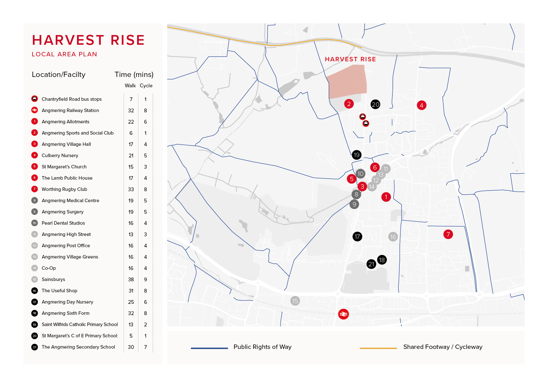
There is a network of Public Rights of Way (PRoW) available – full details of the routes can be found at: iMap – West Sussex County Council
National Cycle Network
The National Cycle Network provides huge benefits to health and wellbeing, with 4.4 million people using the network between 2017 and 2018. 786 million walking and cycling trips were made on the Network. As a result, £88 million was saved through reduced road congestion.
For more information on the National Cycle Network visit the SUSTRANS website: