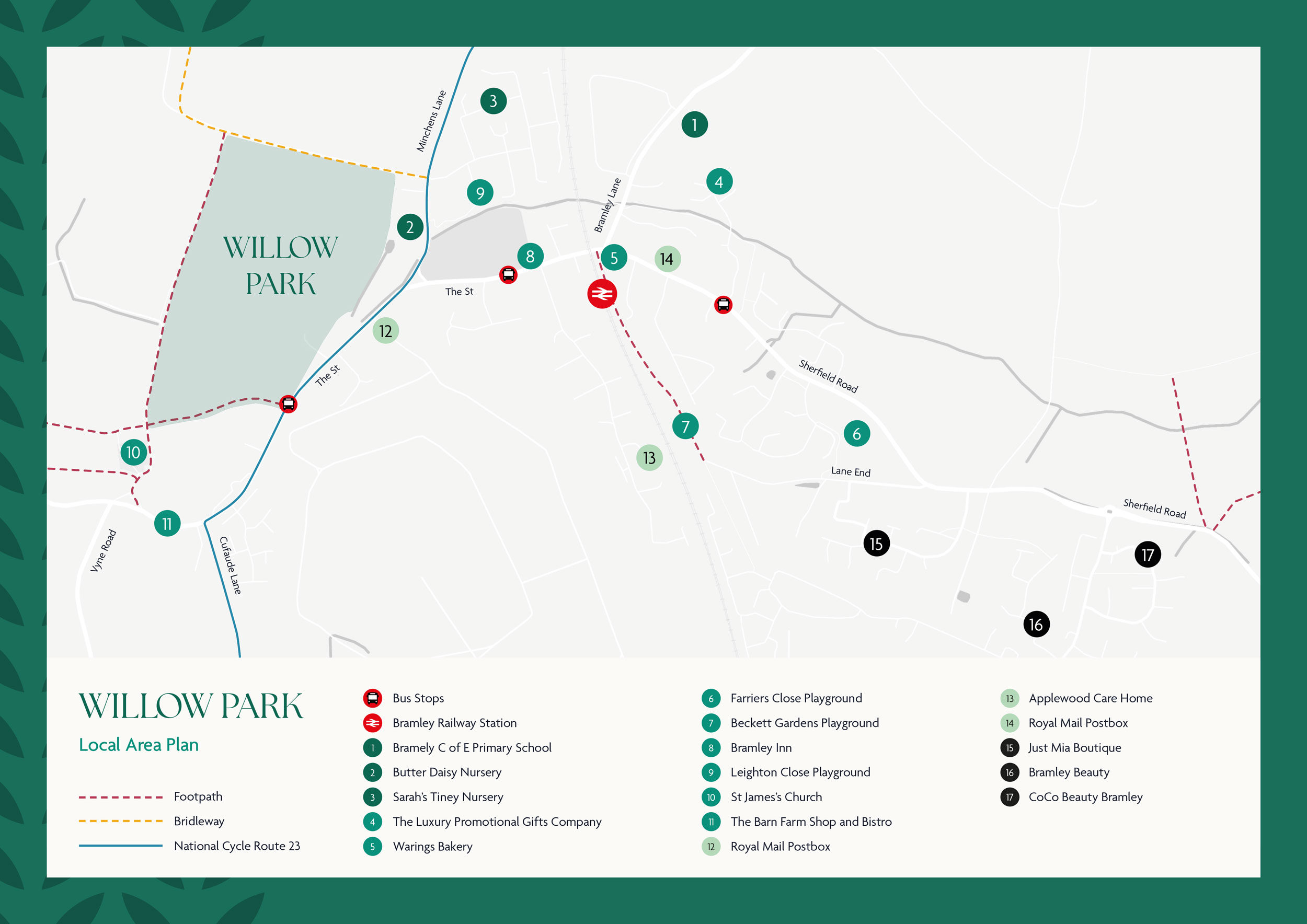
There are a number of walking routes available near Willow Park, including footways along The Street towards central Bramley. Sherfield Road, for journeys towards the office park and playgrounds, also has a footway available. There are also footways on Bramley Lane for access to the primary school.
There is a network of Public Rights of Way (PRoW) available, including a Bridleway to the north of the development that forms part of a long-distance trail between Andover and Aldershot, known as Brenda Park Way – full details of the routes can be found at: Hampshire Rights of Way Map
Take a look at your local walking and cycling routes below:
National Cycle Network
Most of the roads within Bramley are suitable for cycling. However, National Cycle Route 23 connects Reading and Southampton via Basingstoke, and is an on-road cycle route which runs through the village via Cufaude Lane, The Street and Minchens Lane.
The National Cycle Network provides huge benefits to health and wellbeing, with 4.4 million people using the network between 2017 and 2018. 786 million walking and cycling trips were made on the Network. As a result, £88 million was saved through reduced road congestion.
For more information on the National Cycle Network please visit the Walk Wheel Cycle Trust website: Walk Wheel Cycle Trust